Where should you go skiing this weekend?! Tetsuji Hyodo, "Japan's best skiing weather forecaster," predicts the powder snow this weekend.
Overview of this weekend
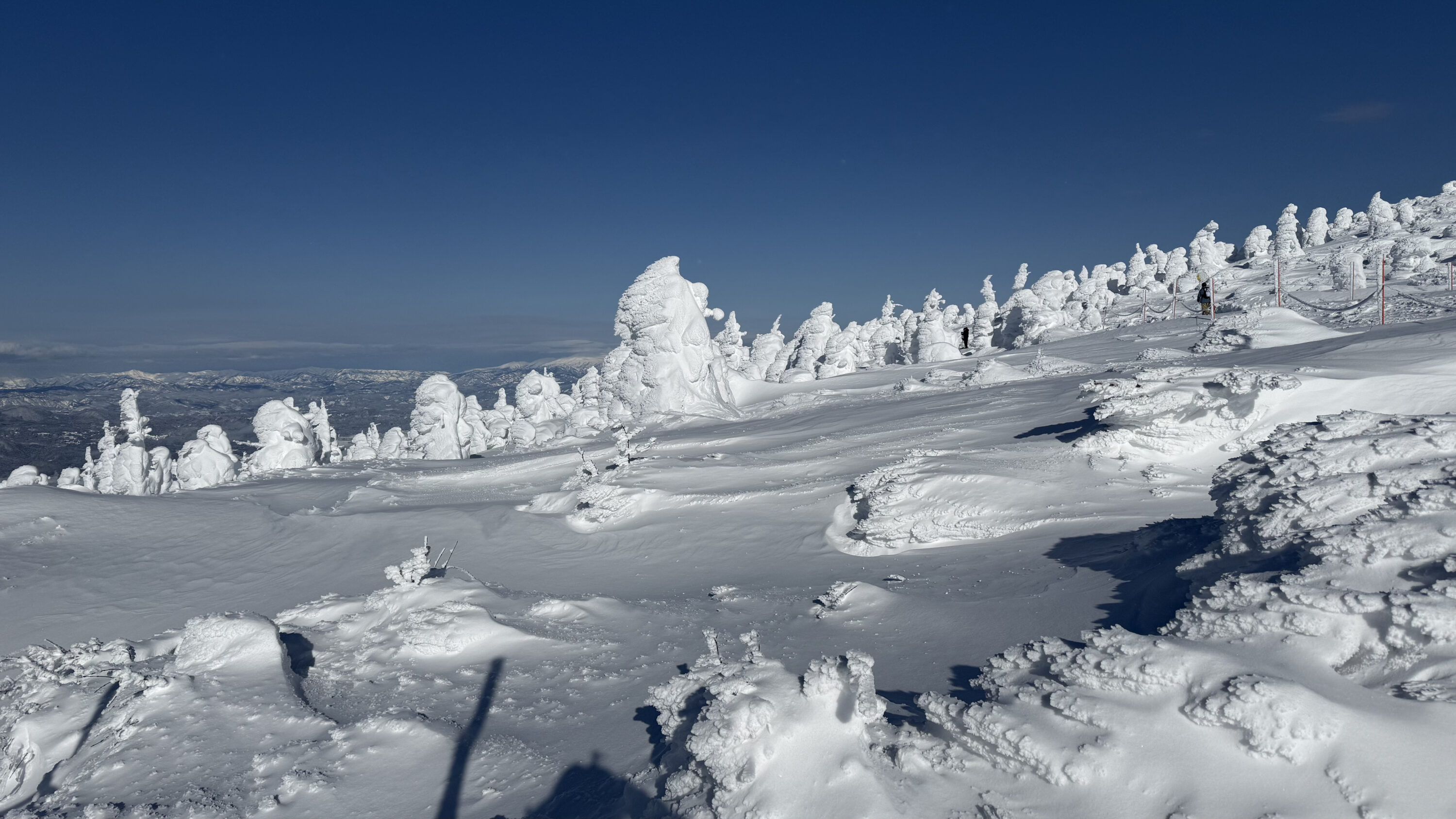
Last week, a cold wave brought heavy snowfall. It seems that some areas received too much snow. This weekend, a winter-like atmospheric pattern will begin today, and heavy snowfall is expected to continue through Saturday. There are still plenty of opportunities to ski on the fresh snow. So, let's take a look at this week's forecast
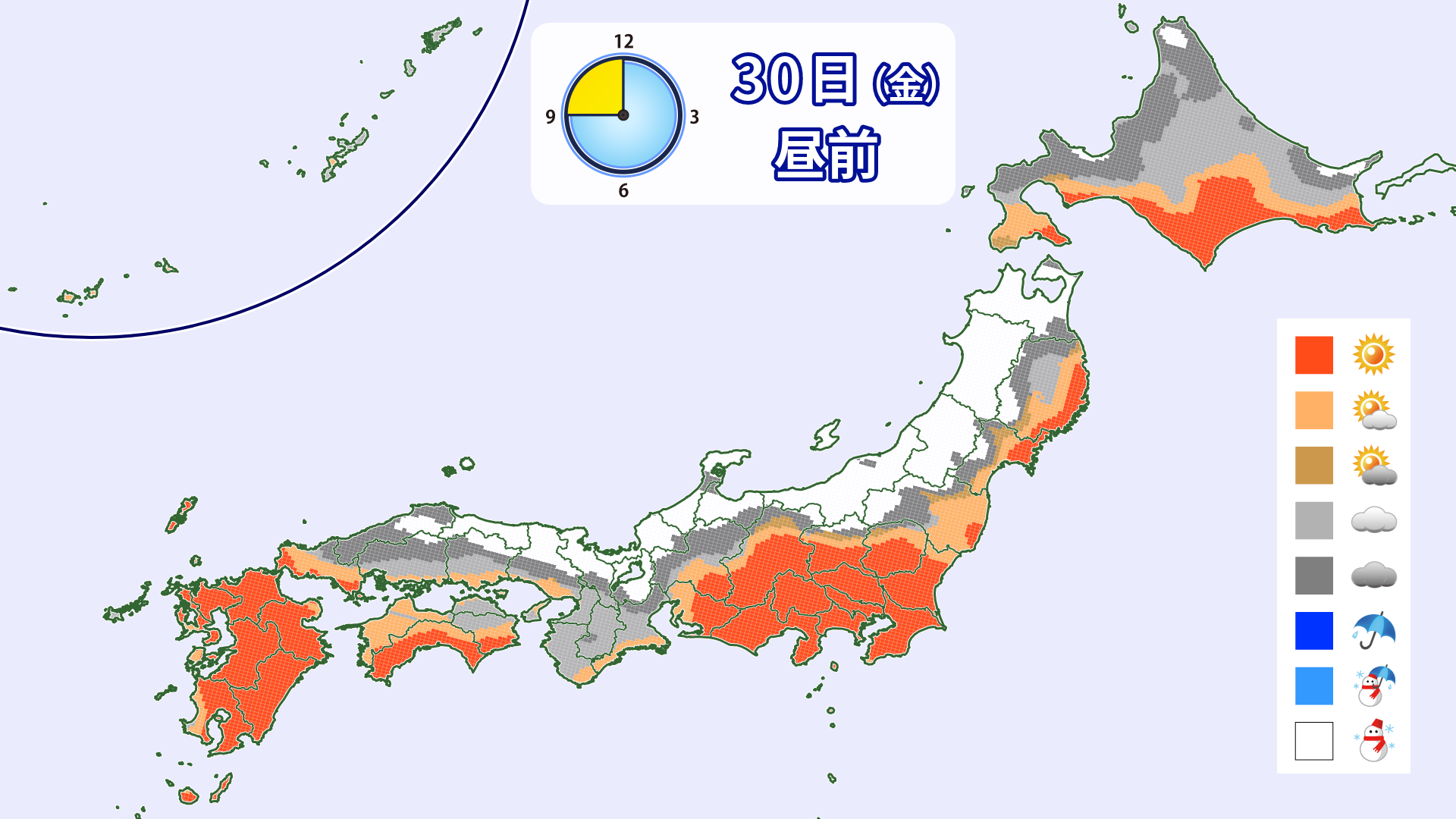
Through Friday, January 30th

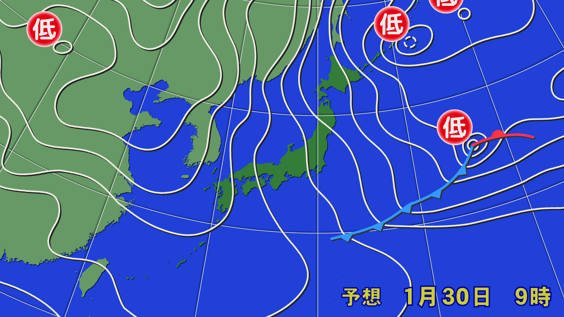
On Friday the 30th, the spacing between the eastern pressure lines will narrow, and the winter pressure pattern is expected to strengthen. Snow will continue to accumulate, mainly along the mountains on the Sea of Japan side, on the night of Thursday the 29th. On Friday the 30th, the JPCZ (Japan Sea Polar Air Mass Convergence Zone) is expected to weaken and move from Kinki to Sanin. Heavy snow is expected in some areas of Hokkaido's Oshima Peninsula and northern Tohoku due to the influence of a small low pressure system and shear line
[Hokkaido area]
The winter pressure pattern will weaken in the morning, resulting in cloudy to sunny skies. From Thursday the 29th to the morning of Friday the 30th, some snow is expected to accumulate in southern Hokkaido and around Hakodate, but not much. Snow is expected to fall on the Sea of Japan side on the night of Friday the 30th
[Tohoku area]
Snow will fall on and off. A convergence zone is expected to cover the Aomori Prefecture area during the day, and snow is likely to suddenly intensify around noon in Owani and Hakkoda. Please be careful on your way home. Southern Tohoku is likely to experience strong winds and blizzards. Please pay close attention to lift operation information
[Yuzawa area]
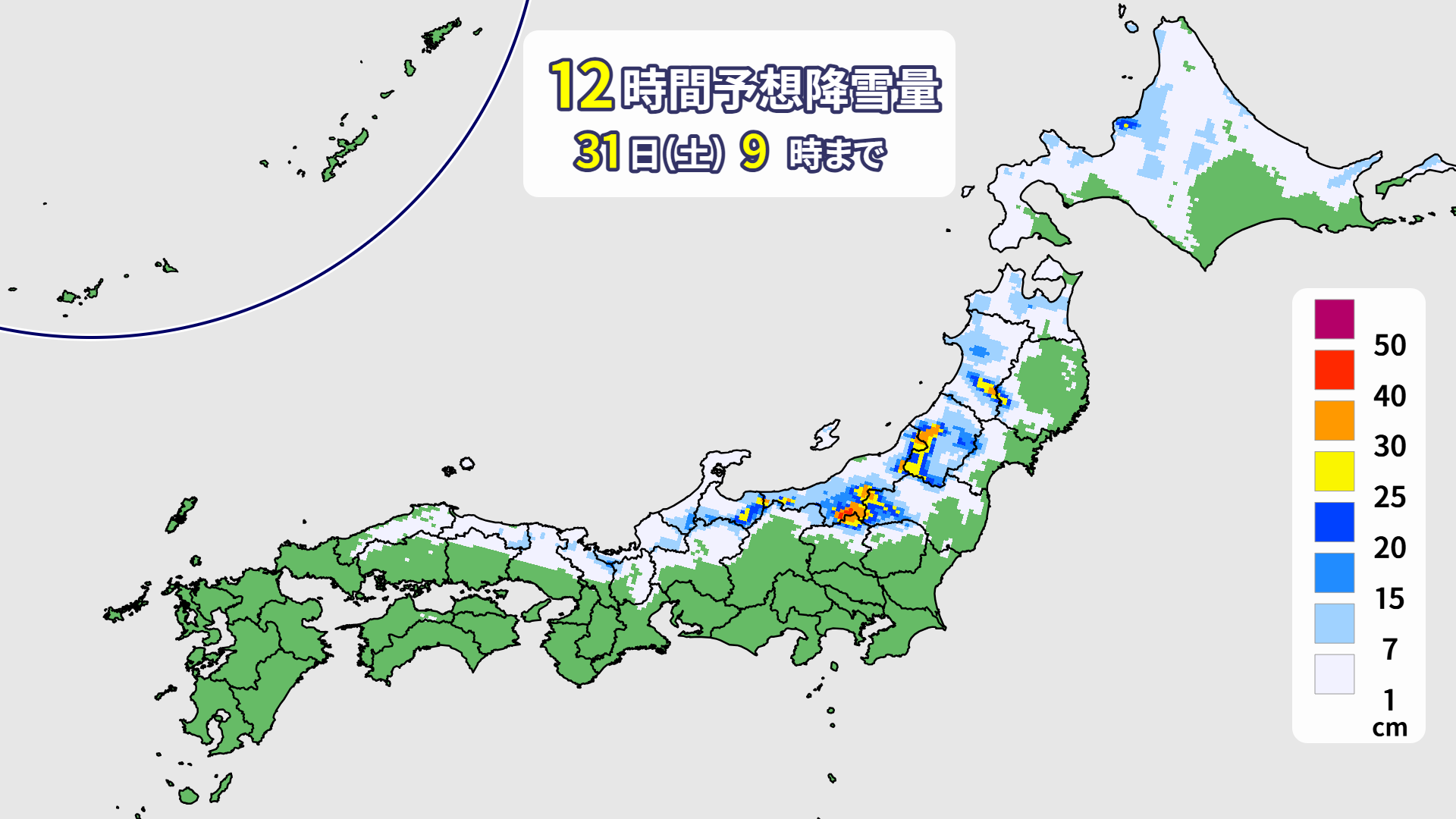
It will snow all day. The temperature will be low, so we can expect powder snow. It looks like about 20 to 30 centimeters of snow will accumulate by the morning of Friday the 30th
[Shinetsu area]
Snow will fall on and off during the day, with around 10 to 20 centimeters expected to accumulate by the morning of Friday the 30th
[Joetsu area]
There will be periods of intermittent snowfall during the day, with some periods of cloudy skies and sunshine. Around 30 centimeters of snow is expected in some areas by the morning of the 30th (Friday), so if you're looking for powder snow, it's best to head out early in the morning
[Other areas]
The JPCZ is moving from Wakasa Bay to the Kinki region. Fukui Prefecture, Shiga, Hyogo, Tottori, and other areas are expected to see significant snowfall through the morning of Friday, the 30th, and in some cases, it could be quite heavy. Snow will likely fall on and off during the day. There may be road closures and restrictions. Please check road information
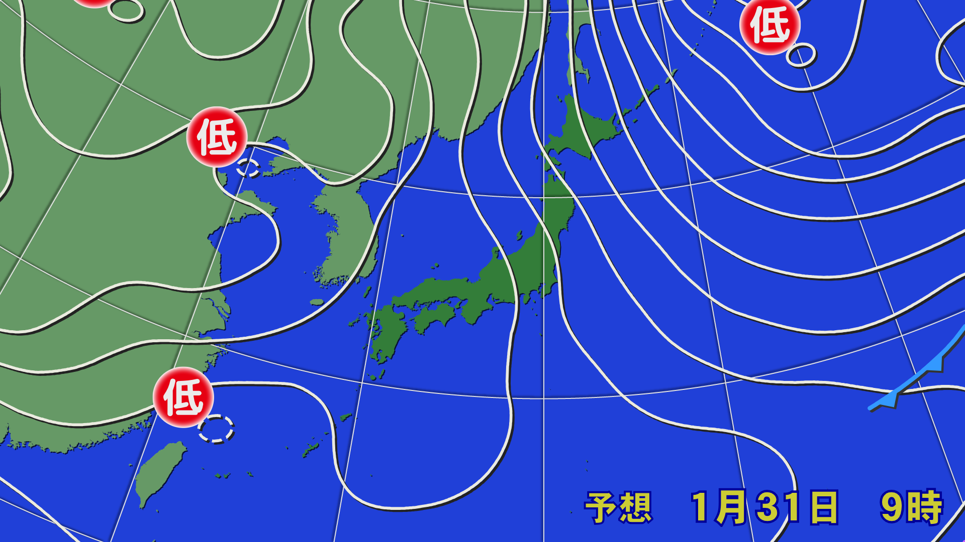
Through Saturday, January 31st
On Saturday the 31st, a high pressure system will extend over western Japan, bringing a halt to the snow. Meanwhile, a winter-like pressure pattern will continue in eastern and northern Japan, bringing snowfall during the day. However, as the cold air above will be moving away, the snowfall is unlikely to be too heavy
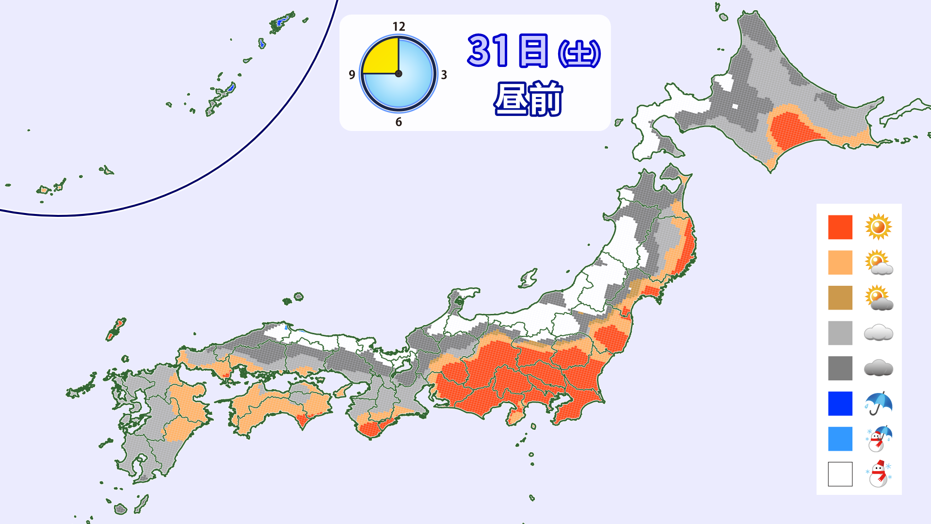
[Hokkaido area]
The spacing between isobars will narrow, and snow will fall mainly on the Sea of Japan side. Some snow is expected to accumulate in Rumoi and Ishikari by morning. Northwesterly winds are expected to strengthen slightly on the Sea of Japan side
[Tohoku area]
The winter pressure pattern will continue, and snow will fall on and off. As the cold air above passes, the snowfall will likely calm down. Winds will be somewhat strong, and there will be blizzards in higher elevations
[Yuzawa area]
Due to the influence of a low-pressure trough in the sky, heavy snowfall is expected from the night before through the morning of Saturday, the 31st. Up to 30 centimeters of snow may accumulate by the morning of Saturday, the 31st. Winds are expected to be somewhat strong, resulting in blizzards
[Shinetsu area]
Snow will fall on and off during the day. The wind is not expected to be very strong. About 10 centimeters of snow is expected to accumulate by the morning of the 31st (Sat)
[Joetsu area]
Snow will continue on the Niigata side, but it will be cloudy on the Hakuba side, so there may not be much snowfall. About 20 centimeters of snow is expected to accumulate on the Niigata side by the morning of Saturday, the 31st. If the wind shifts a little more northwesterly, snow will likely accumulate in Hakuba as well
[Other areas]
The JPCZ will dissipate and snowfall in western Japan will cease. Snow is expected to fall in parts of Hokuriku and Kinki during the day
Through Sunday, February 1st
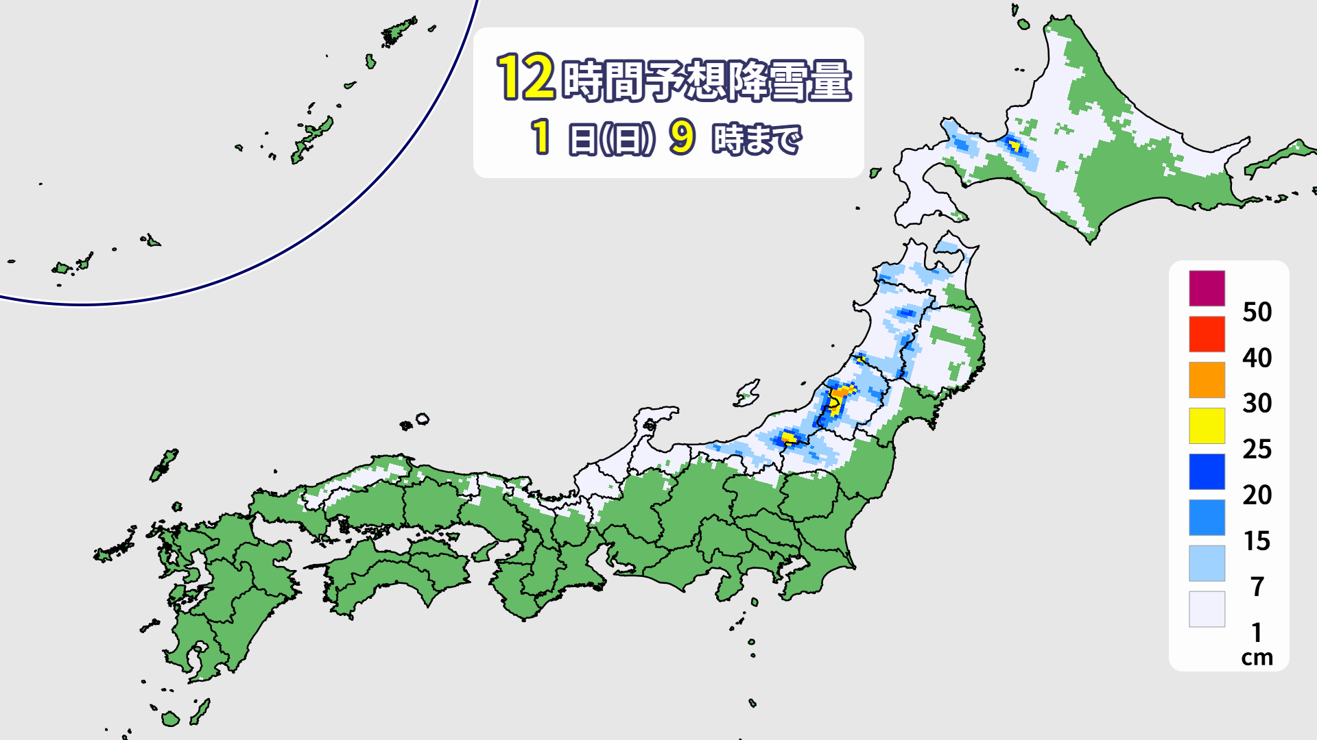
The winter pressure pattern is expected to ease for the time being. The snow will stop during the day and it will be cloudy in many places
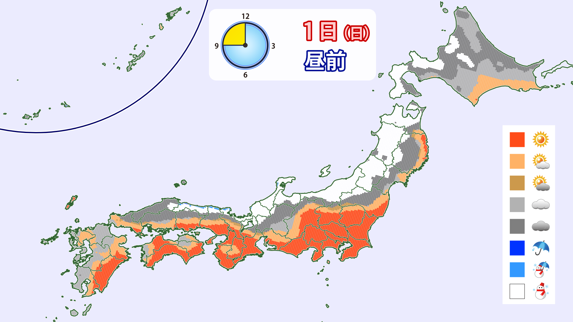
[Hokkaido area]
The wind will calm down a little, but due to a low pressure trough and wind convergence, snow will fall mainly on the Sea of Japan side, and there will be areas where the snow will be heavy and the wind will be strong. A little snow is expected to accumulate mainly on the Sea of Japan side through the morning of Sunday, February 1st
[Tohoku area]
The winter pressure pattern will weaken, and the snow will gradually weaken. A light accumulation is expected by the morning of the 1st (Sunday)
[Yuzawa area]
The wind will die down and there will be periods of cloudy skies and sunny skies. It looks like there will only be a slight accumulation of snow by the morning of the 1st (Sunday)
[Shinetsu area]
There will be a lot of cloudy and sunny spells. There will be little snow in the morning of the 1st (Sunday), but it will be cold in the morning and will turn into dry powder
[Joetsu area]
The snow will stop falling during the day and there will be periods of sunshine. It looks like there will be only a slight accumulation by the morning of the 1st (Sunday)
[Other areas]
There will likely be some light accumulation in some areas into the morning of the 1st (Sunday), but it will be sunny or cloudy during the day
At the end
The cold wave is over, but it's not going to suddenly get warmer from here on out, and the one-month forecast predicts temperatures and snowfall will be around average. There's a lot of variance in the forecast, so it's possible that another cold wave could come. I think the amount of snow has increased significantly with this cold wave, so until the next big snow shower arrives, let's enjoy the feeling of fresh snow over the weekend in areas where it snows