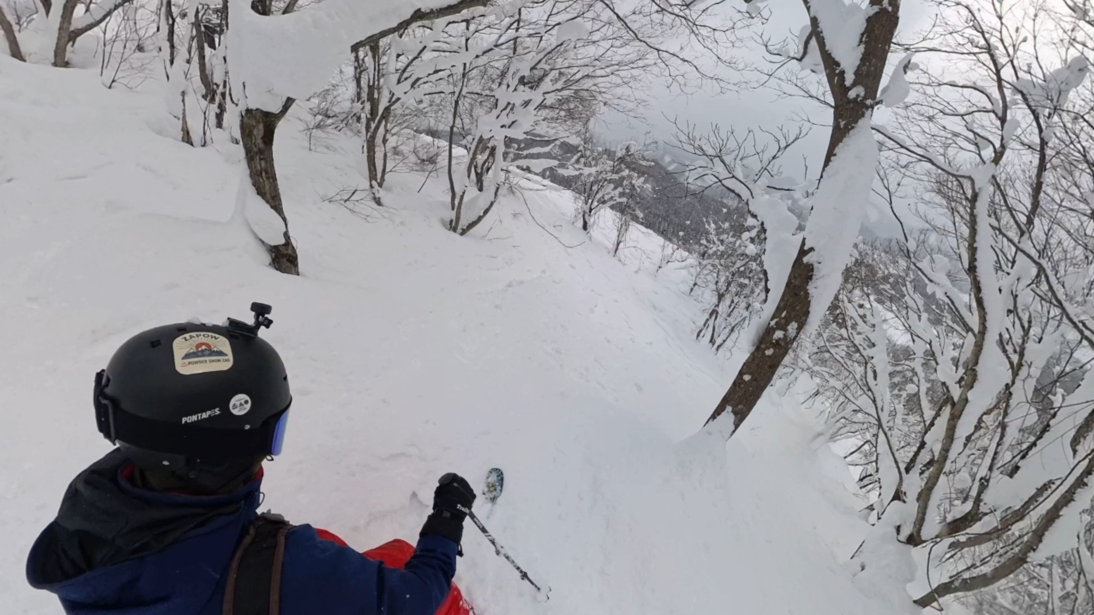
Where should you go skiing this weekend?! Tetsuji Hyodo, "Japan's best skiing weather forecaster," predicts the powder snow this weekend.
Overview of this weekend
Last week, a cold wave brought heavy snowfall. It seems that some areas received too much snow. This weekend, a winter-like atmospheric pattern will develop from Thursday the 5th, and heavy snowfall is expected to continue through Saturday the 7th. There are still plenty of chances to ski on the fresh snow! So, let's take a look at this week's forecast
Through Friday, February 6th
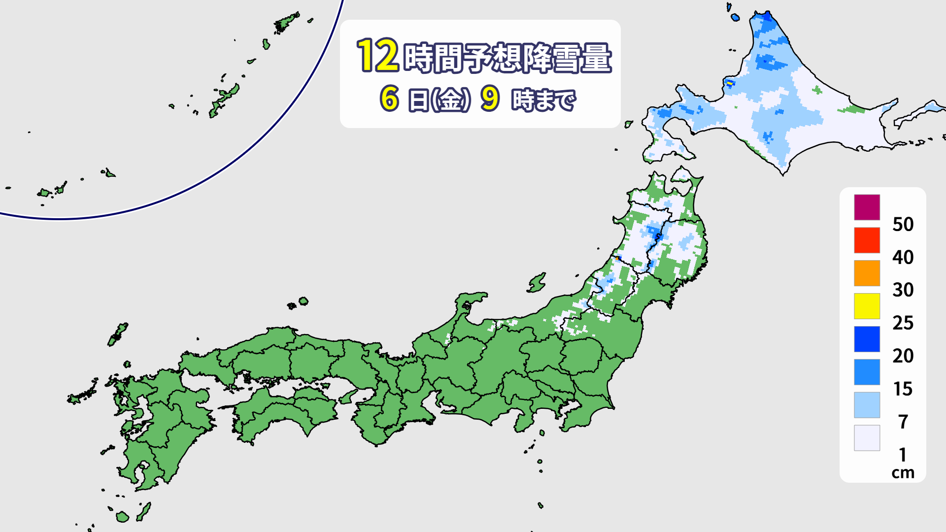
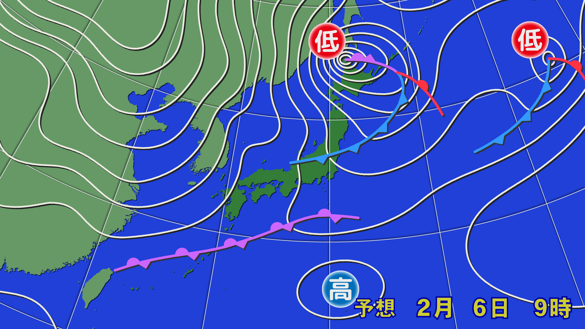
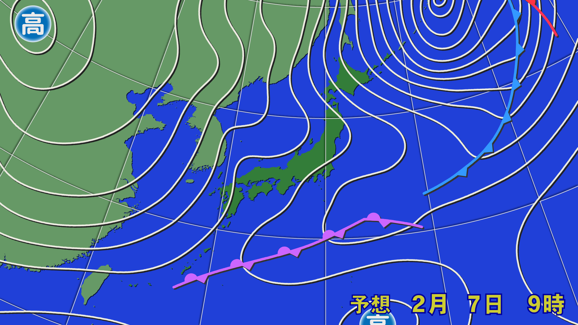
On Friday the 6th, a low pressure system will rapidly develop and move towards the Sea of Okhotsk. The winter pressure pattern will strengthen, bringing heavy snowstorms and severe storms, especially in Hokkaido and northern Tohoku
[Hokkaido area]
Hokkaido will experience strong winds from the west to north, causing heavy snowstorms, especially on the Sea of Japan side. Some ski resorts may not be able to open. Snow will begin falling from the night of Thursday, the 5th, and will accumulate by the morning of Friday, the 6th. However, as the wind is strong, snow may be blown away in some places depending on the temperature and wind
[Tohoku area]
On the night of the 5th (Thursday), snow will fall only in high-altitude areas, with some lower-altitude ski resorts experiencing rain. The weather will gradually change to snow during the day on the 6th (Friday), but it will likely be heavy and wet, so a highly water-repellent wax would be a good idea. Also, please be aware that strong winds and blizzards are expected in northern Tohoku, so please check the lift operation status
[Yuzawa area]
There will be no snow or rain on the night of the 5th (Thursday). Rain or snow is expected to start falling around noon on the 6th (Friday). The powder festival will have to wait for a while
[Shinetsu area]
There will be no snow on the night of the 5th (Thursday). Gradually, rain and snow are expected to fall from the morning of the 6th (Friday). It will turn into snow during the day, but it will be wet snow. Use water-repellent wax
[Joetsu area]
There will be almost no snow or rain on the night of Thursday the 5th. From the morning of Friday the 6th, it will rain in low-altitude areas and on the Niigata side. In Hakuba and other areas, it will start to snow and become wet snow. On the Niigata side, it is expected to gradually turn to snow and become somewhat heavier. We are looking forward to Saturday the 7th
[Other areas]
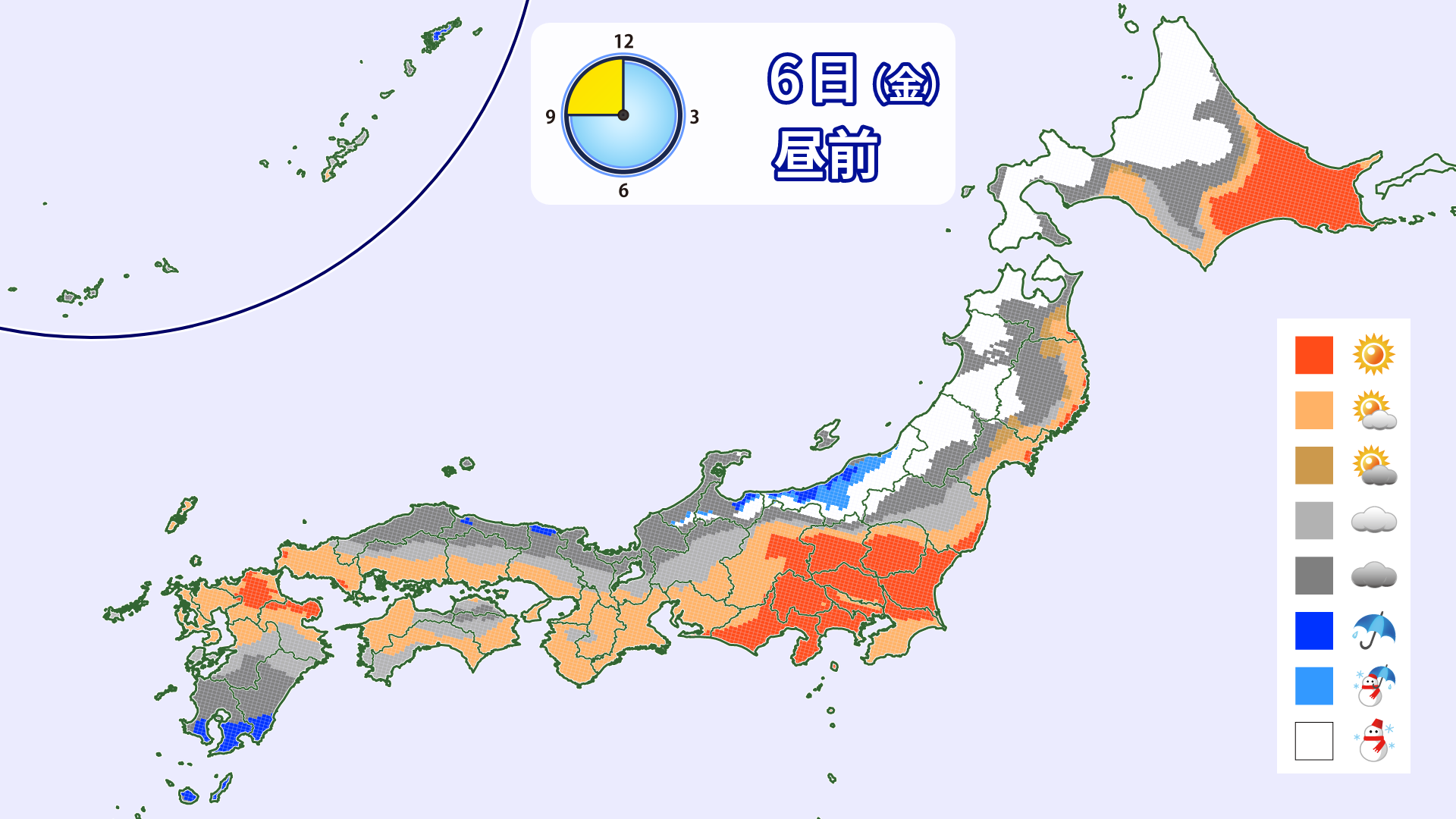
Most areas will be sunny or cloudy through Friday the 6th. Temperatures will be high in western Japan, and the snow will be slushy. High-temperature wax is recommended
Through Saturday, February 7th
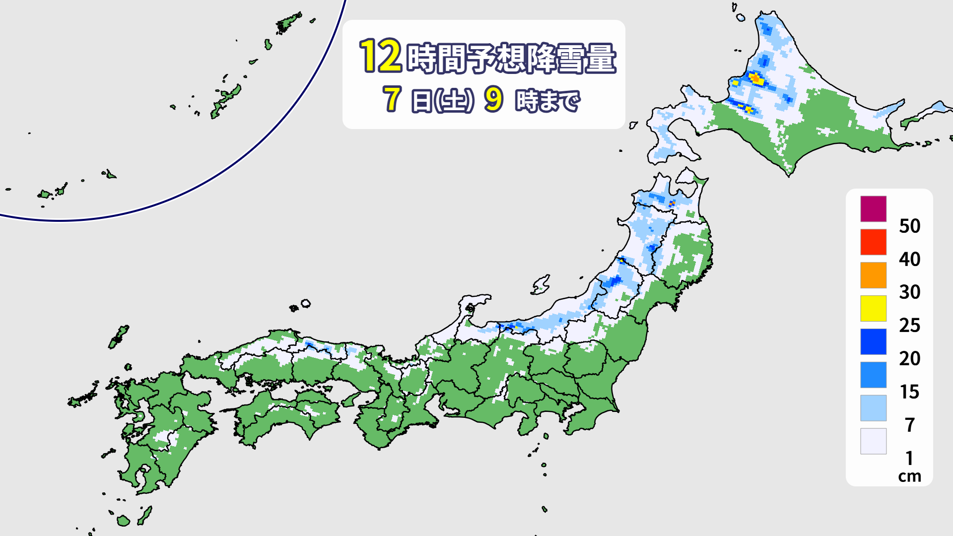
On Saturday the 7th, the cold air will intensify, and snow will fall in western Japan. Hokkaido is expected to continue to experience strong winds and blizzards. There is also a possibility of heavy snowfall as the winds converge

[Hokkaido area]
The winds will calm down a bit, but snow and blizzards will continue, mainly along the Sea of Japan coast. The winds will converge in the Rumoi and Ishikari regions, bringing heavy snowfall to some areas. It is predicted that around 20 centimeters of snow will accumulate in some areas by the morning of Saturday, the 7th. Heavy snowfall may continue during the day, so please be aware of road conditions
[Tohoku area]
The cold will intensify, and snow will fall. The wind will be slightly strong, and not enough to stop the lifts, but it may be stronger than expected in northern Tohoku. About 10 centimeters of snow is expected to accumulate by the morning of the 7th (Sat)
[Yuzawa area]
The wind is not very strong, so the snow clouds will not be moving in very strongly. It will snow, but it will not be heavy. It is expected to accumulate lightly by the morning of the 7th (Sat)
[Shinetsu area]
It is expected that the snow will accumulate lightly through the morning of the 7th (Sat). The snow will continue during the day. The temperature will drop, powder snow will fall, and the slope conditions are expected to improve
[Joetsu area]
By the morning of the 7th (Sat), about 10 to 20 centimeters of snow will accumulate. Temperatures will also drop, so we can expect powder snow. Snow will continue throughout the day. The snow quality is also expected to improve
[Other areas]
Light snow is expected to accumulate in Western Japan through the morning of Saturday, the 7th. Temperatures will drop and the snow will become firmer. Snow is expected to fall during the day as well
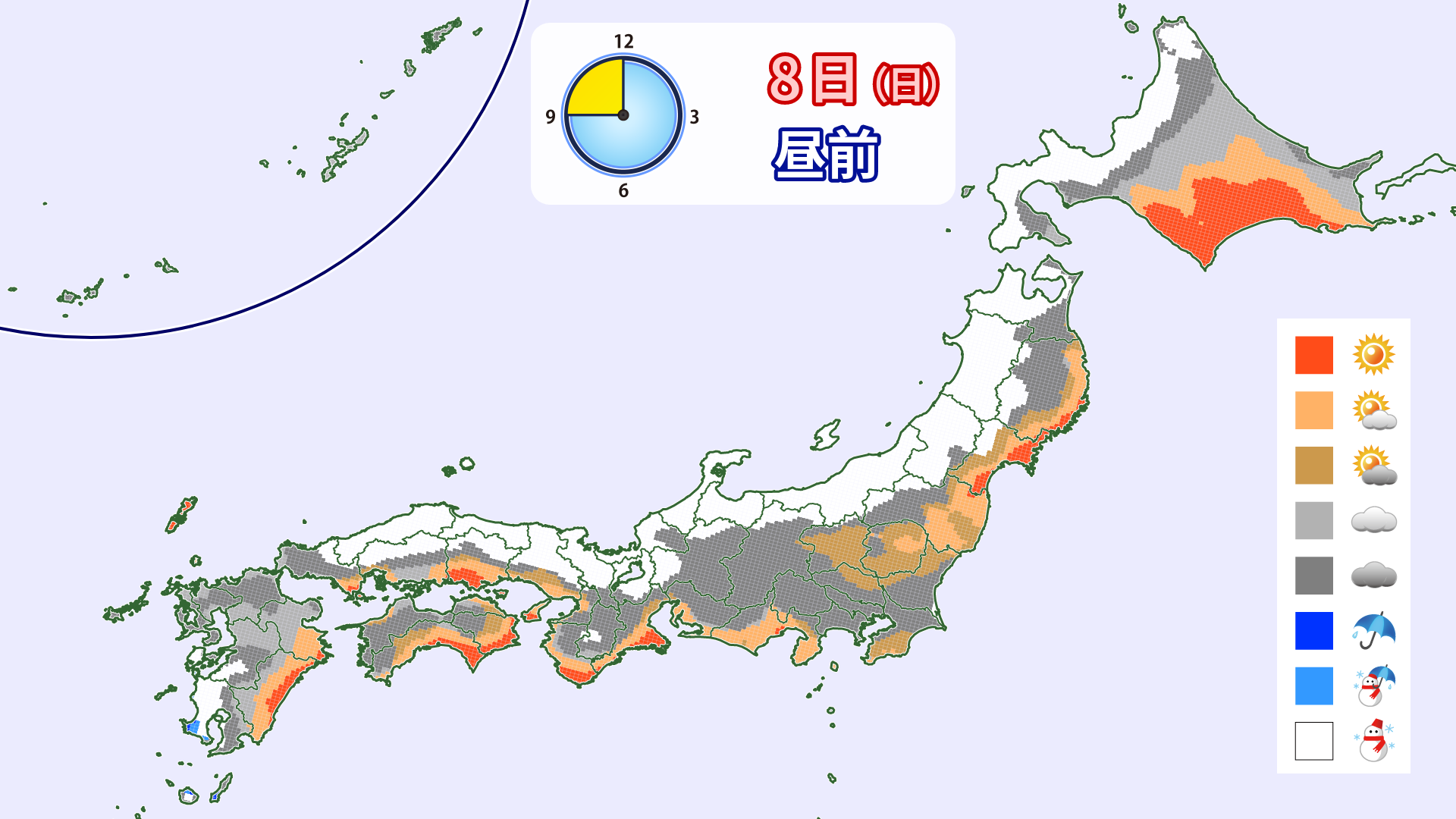
Through Sunday, February 8th
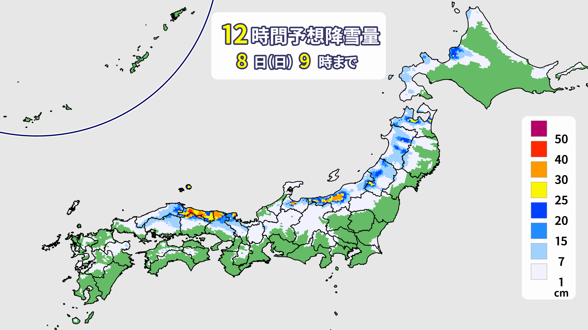
The winter pressure pattern is expected to continue. In addition, as the JPCZ moves from Sanin to the Hokuriku region, heavy snow will likely fall in some areas. Please also be aware of road information such as disruptions to transportation and road closures
[Hokkaido area]
The snow will be falling more slowly and the area will be smaller, mainly on the Sea of Japan side. The wind will also weaken, so Sunday the 8th is likely to be the most comfortable day for skiing at ski resorts where snow has accumulated from the previous day
[Tohoku area]
Snow will continue during the day on the 8th (Sunday). As cold air above intensifies, snowfall is likely to intensify locally. Beware of heavy snow. Up to 20 cm of snow is expected to accumulate in some areas by morning. Winds will be moderately strong. If you're looking for powder snow, the 8th (Sunday) is recommended
[Yuzawa area]
Cold air above is expected to intensify, causing snow clouds to develop. Snowfall will intensify during the day, and there is a possibility of heavy snowfall. Please be aware of road conditions and disruptions to public transport on your way home. About 10 centimeters of snow is expected to accumulate by the morning of Sunday the 8th. Winds will also strengthen, and there is a risk of blizzards
[Shinetsu area]
The snow will intensify, with about 10 centimeters expected to accumulate by the morning of the 8th (Sunday). Cold air will intensify during the day, and the snowfall is expected to intensify. The winds will also strengthen, so there is a possibility of blizzards
[Joetsu area]
By the morning of the 8th (Sunday), it looks like 10 to 30 centimeters of snow is expected to accumulate. Cold air will intensify in the upper atmosphere, and heavy snow is possible during the day. Heavy snow is especially likely on the Niigata side, so be sure to check traffic information
[Other areas]
The Japan Sea Polar Air Mass Convergence Zone (JPCZ) is expected to move from Sanin to the Hokuriku region from the night of the 7th (Sat), and heavy snow is expected in Sanin and northern Kinki by the morning of the 8th (Sun). Please check the slope and road information carefully. Heavy snow will fall along the mountains during the day as well. There is a possibility of vehicles getting stuck, so be sure to keep water, food, portable toilets, and cold weather gear in your car
lastly
After this weekend's strong cold front, it looks like we won't see any powder events like a cold wave for a while. There will still be some isolated snow days, so please continue to keep an eye on the powder forecast