Where should you go skiing this weekend?! Tetsuji Hyodo, "Japan's best skiing weather forecaster," predicts the powder snow this weekend.
Weekend Overview
Tomorrow, December 19th (Friday)
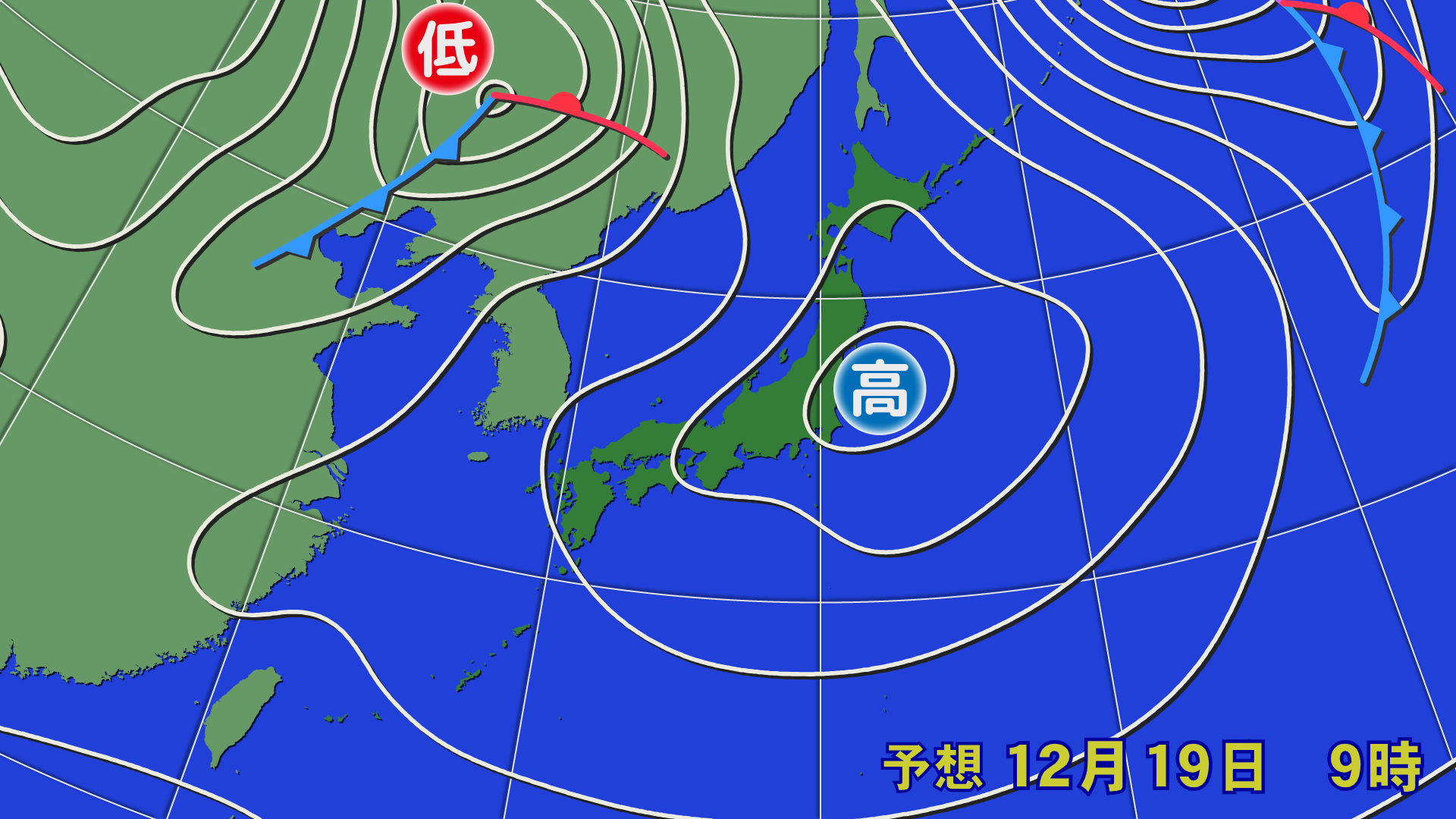
Starting tonight, a high pressure system will cover Japan. Weather across the country is expected to be calm. At an altitude of about 1,500 meters, warm air temperatures above 0°C are expected to move northward into northern Tohoku.

[Hokkaido area]
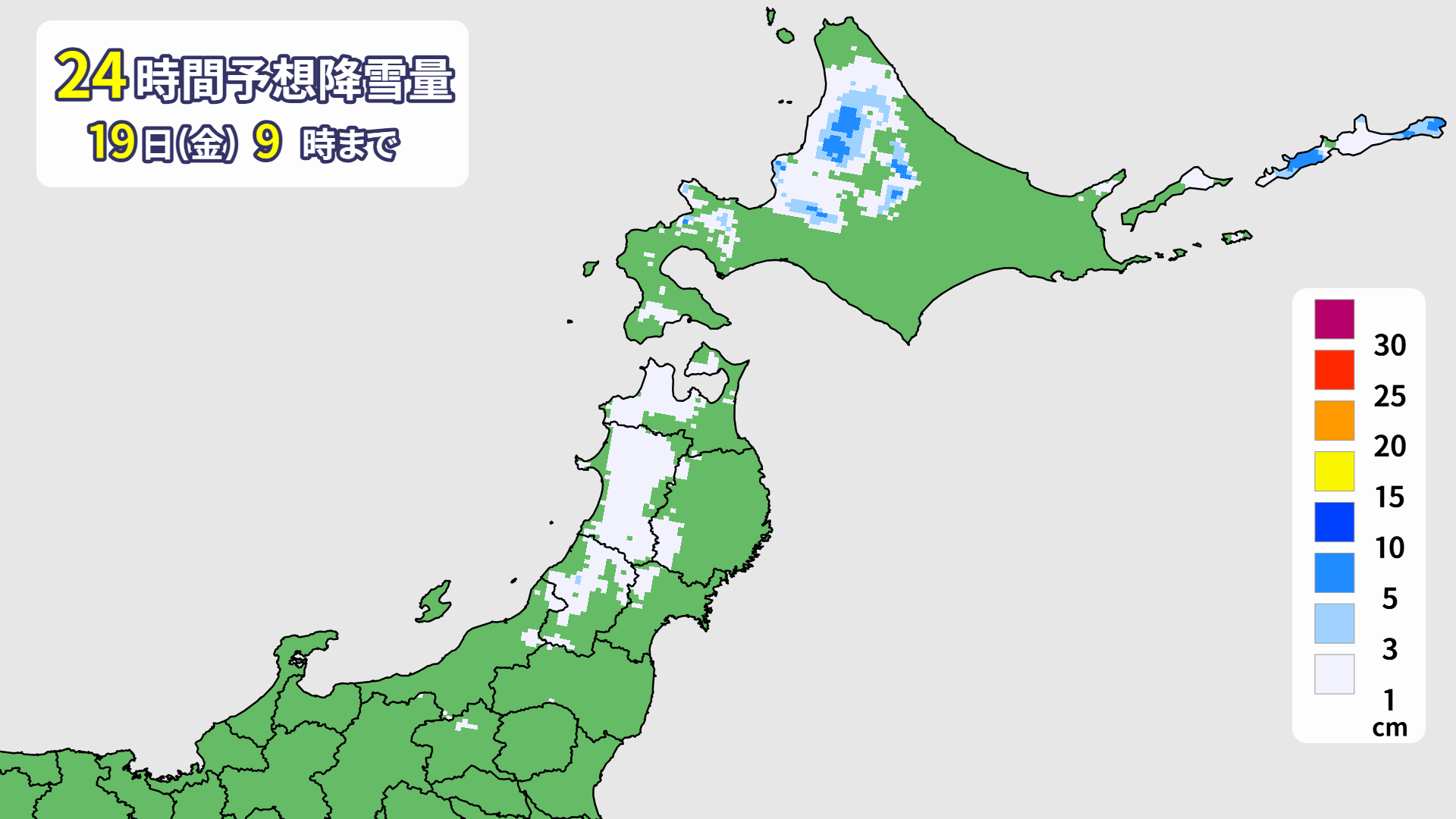
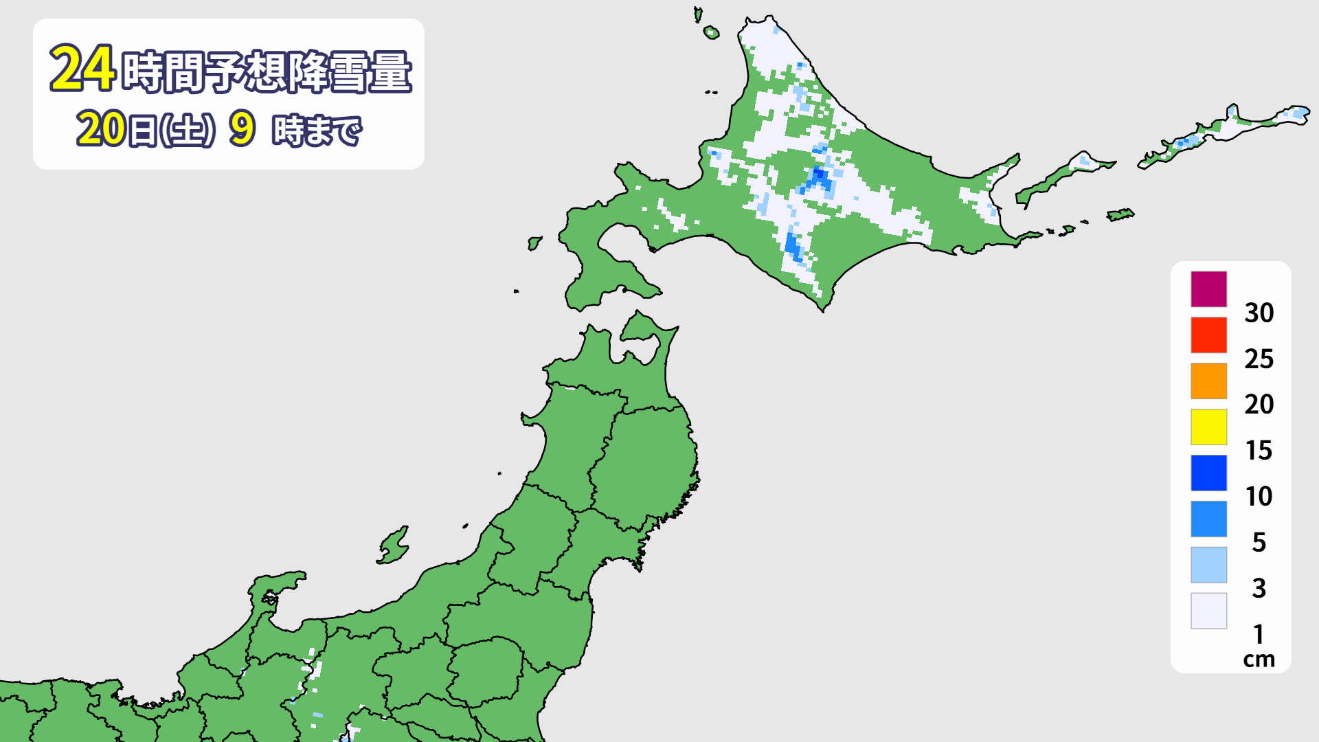
There will be some light snowfall in some areas tonight, but no new significant snowfall is expected by tomorrow morning. It will be cloudy on the Sea of Japan side and sunny on the Pacific side. The maximum temperature will be around 0°C at the bottom, so conditions in the top area are likely to remain relatively stable. In addition, widespread snow will fall at night as a warm front approaches.
[Tohoku, Yuzawa, Shinetsu, Joetsu area]
There will be almost no new snowfall from tonight onwards. Tomorrow, except for northern Tohoku, a high pressure system will cover the area, resulting in widespread sunny skies. The maximum temperature at the bottom will likely reach over 5°C in some areas. The snow will be firm in the morning, but will loosen around noon. Wax suitable for wet snow is recommended.
Through Saturday, December 20th
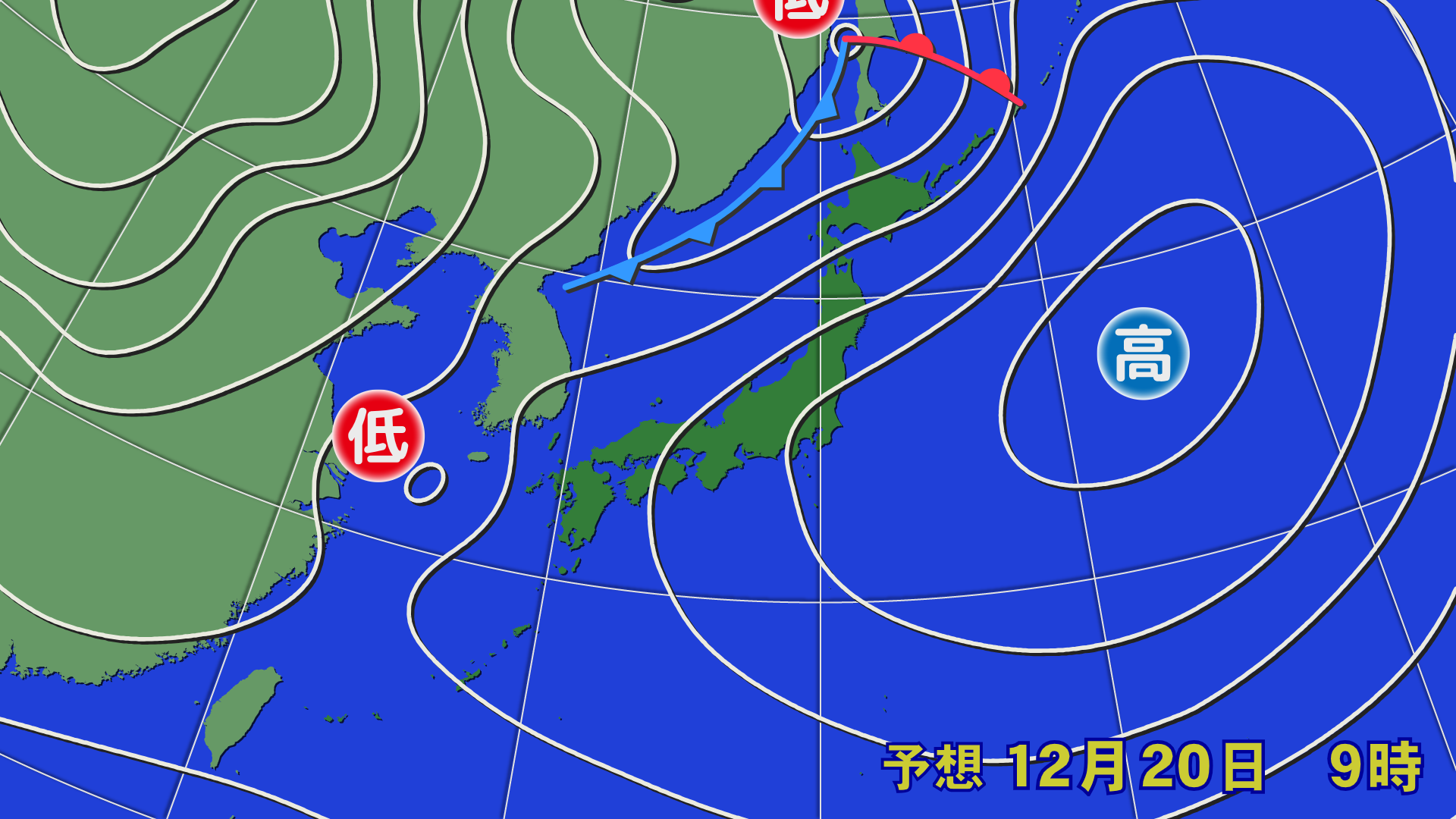
A low pressure system with a front will move north of Hokkaido. Northern and eastern Japan will be the rear of a high pressure system, so southerly winds are expected to blow toward the low pressure system. As a result, warm air will move further north, and temperatures will reach above 0°C in Hokkaido and above 6°C around Honshu at an altitude of about 1,500m. The spacing between isobars will narrow, and strong southerly winds are expected to blow in the mountainous areas of northern Japan and Hokuriku.
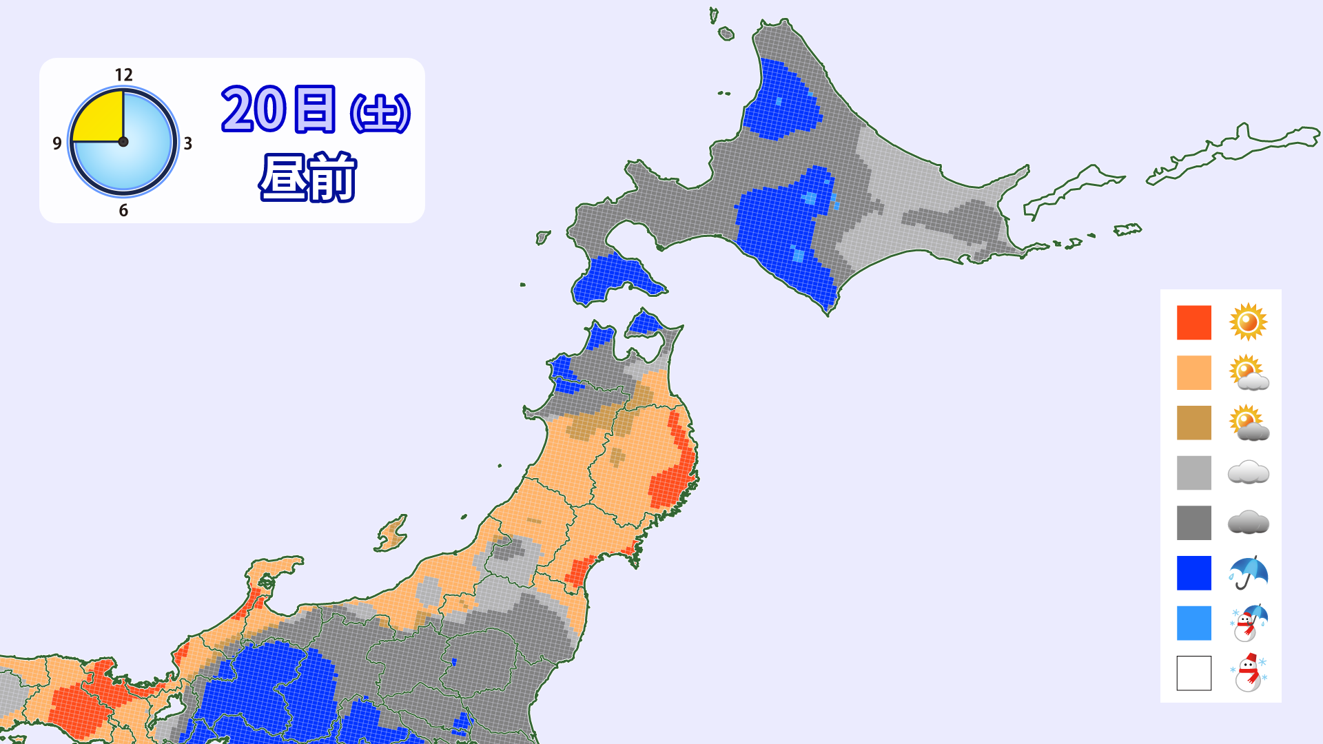
[Hokkaido area]
Snow is expected to fall in some areas, mainly in the mountainous regions around central Hokkaido, through the morning. You may be lucky and find powder in places like Tomamu. However, during the day, moist air will flow into the low pressure system, and rain is expected in some areas of the mountains. Make sure to wax your skis thoroughly. The rain will gradually turn to snow at night. Strong southwesterly winds are expected, with wind speeds exceeding 20 m/s on the southern slopes of the mountains. Please be careful.
[Tohoku, Yuzawa, Shinetsu, Joetsu area]
Due to the influence of a low-pressure trough and moist air above, it will be sunny and cloudy during the day, with some areas experiencing sudden rain showers. It will be chilly in the morning, so be careful of icy surfaces. In the afternoon, rising temperatures and rain will cause rough surfaces. There is a risk of strong winds in northern Tohoku, including Appi. Other areas will also experience some winds.
Through Sunday, December 21st
A low pressure system accompanied by a front will pass through northern Japan, and the low pressure system will also move along the Pacific coast. As a result, rain and snow are expected to fall on and off over a wide area. A winter-like pressure pattern is expected to temporarily develop from this afternoon through Monday. Please be aware that winds may suddenly become stronger as the low pressure system approaches.


[Hokkaido area]
Slightly wet snow will fall in northern Hokkaido and the Sea of Japan side. Rain is expected on the Pacific side. Low-pressure rain and snow may temporarily intensify and continue throughout the day. Slope conditions are expected to deteriorate. Be sure to treat your snowwear with water repellent. Winds will be slightly weaker than expected, at around 10 m/s.
[Tohoku, Yuzawa, Shinetsu, Joetsu area]
Temperatures will be high, with rain falling on and off during the day. The glideability will likely be significantly reduced, so if you're planning on skiing, be sure to wax your skis thoroughly beforehand and remember to use water-repellent coatings on your clothing. Strong southerly winds are likely in areas near the sea in Tohoku, northern Kanto, and Joetsu. Wind speeds on the mountains could reach around 20 m/s. Don't forget to check lift operations and take precautions against the cold and getting wet.
At the end
Unfortunately, the whole country will be enveloped in warm air this weekend, making powder snow unlikely. However, Saturday will be sunny in some areas and temperatures will be high, so it may be a good time to bring beginners.
Snow is expected to accumulate in some areas of Tohoku and Hokuriku on Monday morning, the start of the week. There are also signs of snow around Christmas, so many people may be disappointed by the high temperatures, but winter has only just begun. Let's look forward to the next cold wave.