Where should you go skiing this weekend?! Tetsuji Hyodo, "Japan's best skiing weather forecaster," predicts the powder snow this weekend.
Overview of this weekend

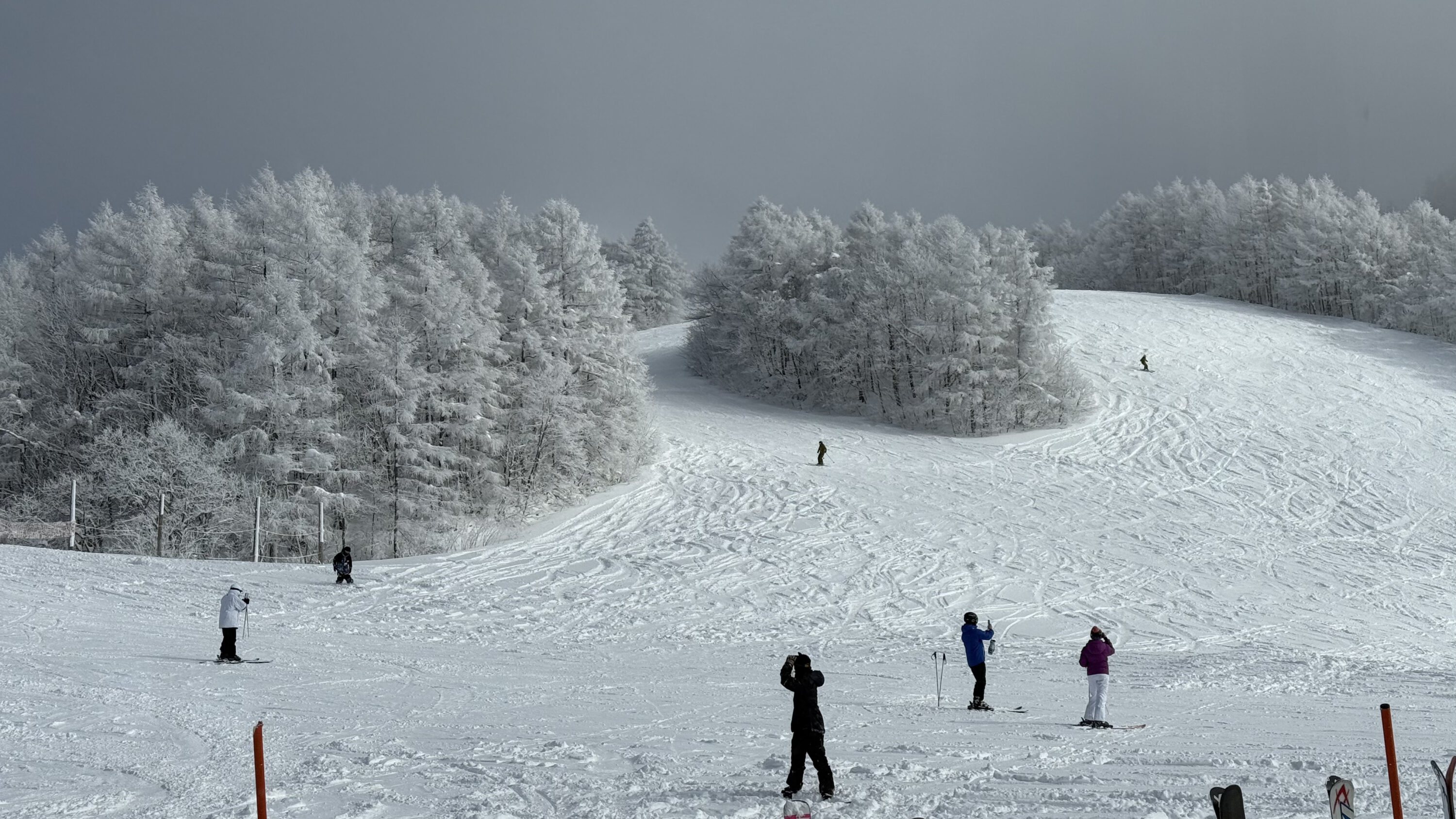
Are you all heading out to the mountains? It's finally peak season
Even so, even though it's January now, there hasn't been a real cold wave, and snow accumulation in mountainous areas seems to be below average in many places. The way the snow has been falling recently has not been a continuation of the winter pressure pattern, but rather a cycle of temperatures rising temporarily as low pressure passes, followed by rain and then snow, making it difficult for the snow accumulation to increase
However, it does still not snow at all, so you can also think of it as being a time when you can enjoy the feeling of fresh snow repeatedly
However, I'm sure there are many of you who are hoping for a cold snap to come
In fact, a long-awaited, full-scale, long-term cold wave is expected to begin around next Tuesday. It is not yet clear how much snow will fall, but it is expected that the amount of snow will increase. If that happens, we can hopefully enjoy a longer season
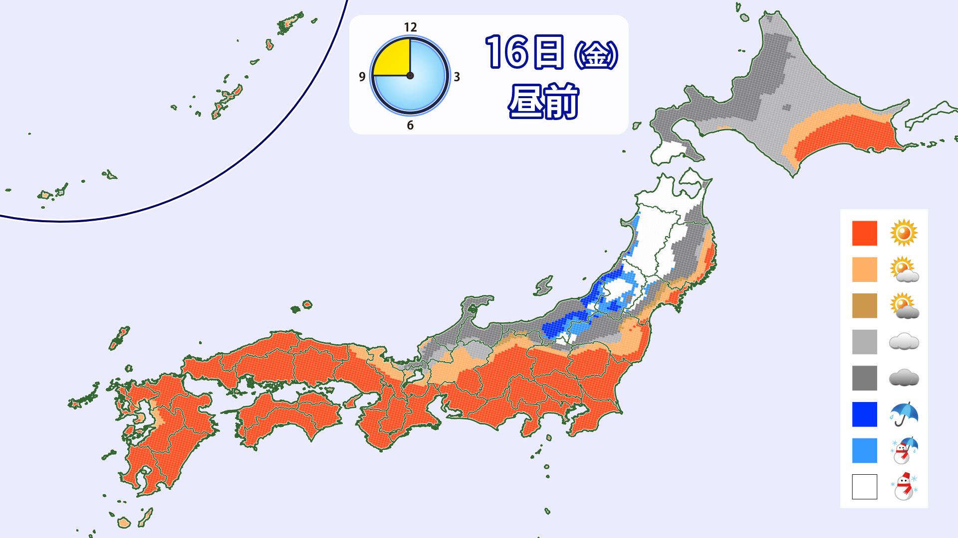
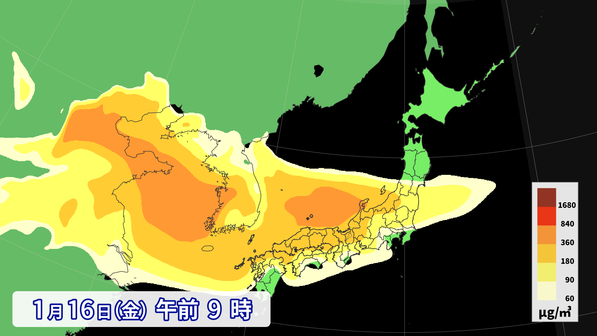
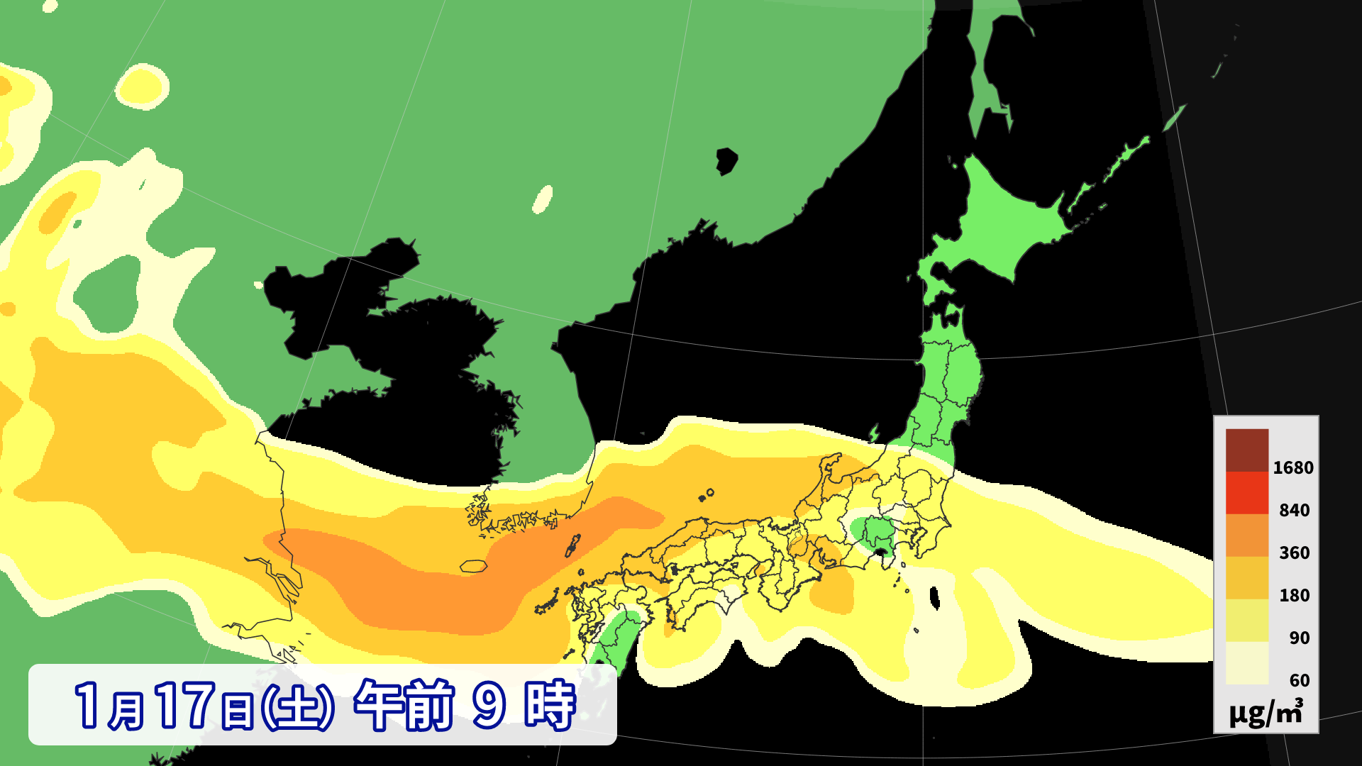
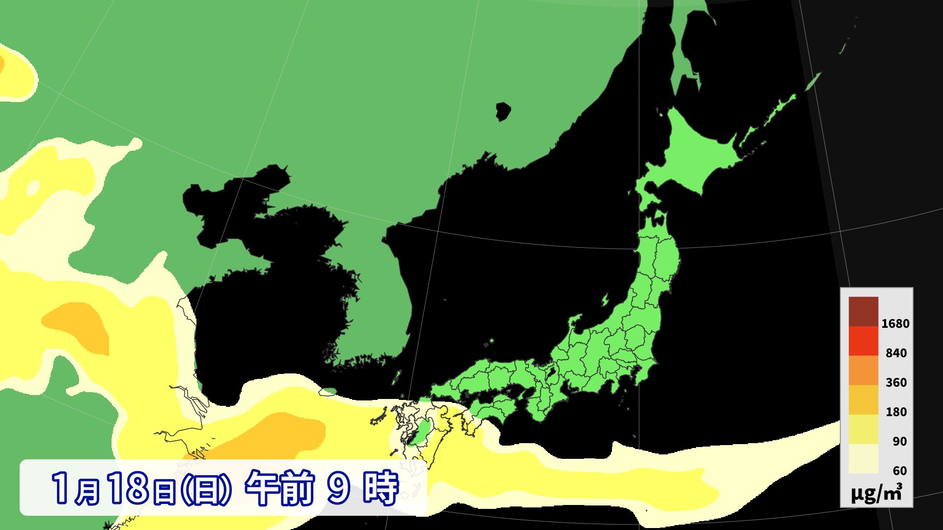
Meanwhile, this weekend is likely to see rain in some areas of the mountains, with snow likely limited to Hokkaido, northern Tohoku, and high-altitude areas. In backcountry (BC) areas, beware of cracks in the snow and avalanches caused by the rain. Furthermore, yellow sand is predicted to arrive over a wide area of Honshu from January 16th to 17th. It's likely to be a weekend where you'll need to be careful when choosing ski wax and maintaining your skis
Through Friday, January 16th

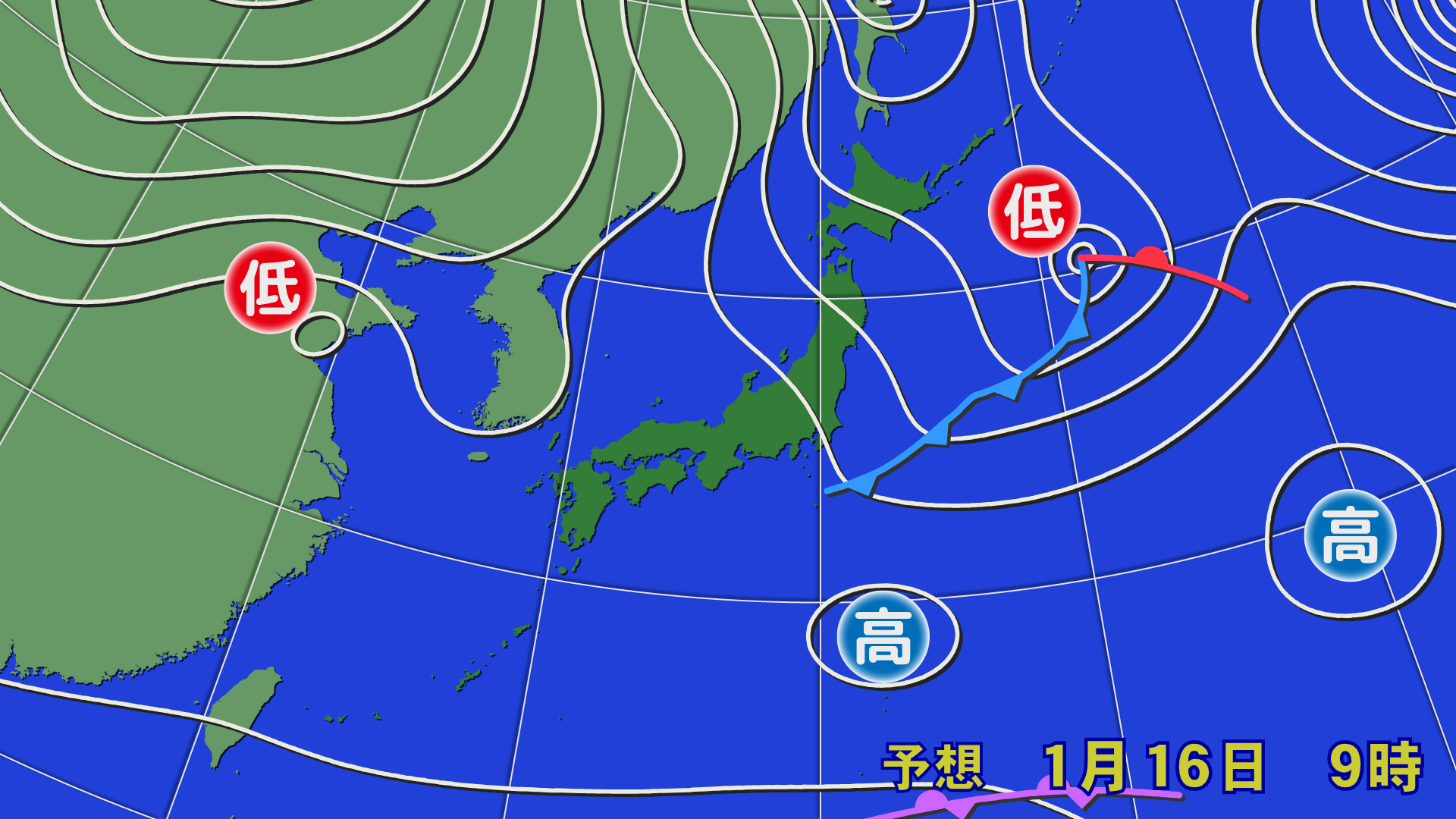
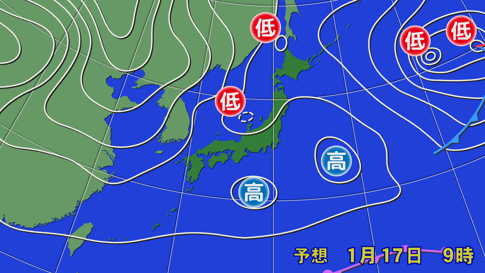
On the night of Thursday, January 15th, a low pressure system will pass through Tohoku, causing warm air to move north. At one point, the 0°C temperature line around 1,500m (the 0°C temperature line that indicates whether snow will fall) will move north to southern Tohoku, bringing rain except for Hokkaido, northern Tohoku, and high-altitude areas. Beware of avalanches in areas with steep slopes and BC areas. On Friday, January 16th, a temporary high pressure system in the west and low pressure in the east will bring in cold air, but it will not move too far south, and rain is likely in some areas of southern Tohoku and Hokuriku, which are at low altitudes. Yellow sand is also expected to spread widely across Honshu
[Hokkaido area]
It will be cloudy on the Sea of Japan side through the 16th, but mostly sunny on the Pacific side. Even in areas where snow falls on the night of the 15th, it will only accumulate lightly. Slightly strong winds are expected around the Oshima Peninsula in the southwest through the 16th
[Tohoku area]
On the night of the 15th, it will likely rain in many areas in the south, even in high-altitude areas. However, as colder air gradually moves in after midnight, the rain in high-altitude areas is likely to turn to snow by morning. Some low-altitude areas will likely see rain. The snow and rain are expected to ease during the day, but strong westerly winds in high-altitude areas may affect lift operations. Yellow sand is also likely to fly in the south
[Yuzawa area]
There will be occasional rain or sleet in some areas on the night of the 15th. On the 16th, wet snow is expected to fall at first, but it will gradually become cloudy. It will be a little windy in the morning, but will gradually die down. Yellow sand is expected to fly
[Shinetsu area]
It will be cloudy from the night of the 15th. There is a chance of wet snow falling in the morning. However, it is unlikely to accumulate much. It will be cloudy during the day on the 16th, with occasional sunshine. Yellow sand will fly
[Joetsu area]
Rain is expected through the morning of the 16th. Beware of crusty snow and avalanches. Tomorrow is expected to be partly sunny and cloudy. Winds will be weak. Yellow sand is expected to fly
[Other areas]
There will be rain in some areas on the night of the 15th. Western Japan is expected to be sunny on the 16th. Temperatures will be high and yellow sand will fly, so be sure to pay attention to waxing and maintaining your skis after skiing
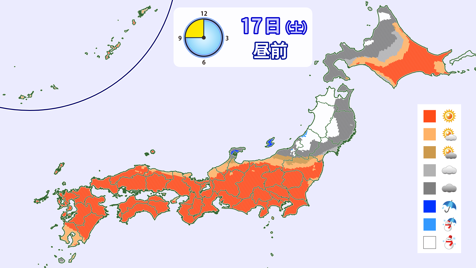
Through Saturday, January 17th

On the night of the 16th, a pressure ridge will form near Japan, meaning few areas will see snow or rain. New snow is not expected. During the day on the 17th, a low pressure system will pass through the Tohoku region again, bringing rain or snow to some areas. Compared to the 15th, snow is expected to fall in slightly more areas, even at lower altitudes. Yellow sand will be flying again on the 17th, so please be careful when choosing wax and performing maintenance after skiing
[Hokkaido area]
It will remain cloudy on the Sea of Japan side, but mostly sunny on the Pacific side. The winds are also likely to remain calm
[Tohoku area]
The snow will gradually stop by the night of the 16th. A low pressure system will pass through in the afternoon of the 17th, bringing snow and rain. Wet snow or rain is expected in low-altitude areas. Atmospheric conditions will be unstable around the low pressure system, so be careful of lightning and gusts of wind. Stronger winds may affect lift operations. Yellow sand may fly in the southern part of the country
[Yuzawa area]
The 17th will be mostly sunny. The wind is expected to be calm. Be careful of yellow sand. Snow will start falling at night
[Shinetsu area]
The 17th will be mostly sunny. Winds are expected to be calm. Be careful of yellow sand. Snow and rain will start falling in the evening
[Joetsu area]
The 17th will be sunny mainly in the morning. Snow and rain are expected to start falling around noon. Please be careful of yellow sand
[Other areas]
Western Japan will be sunny throughout the country. Yellow sand will be flying, so please be careful with waxing and maintenance
Through Sunday, January 18th

From the night of the 17th, a winter pressure pattern is expected to develop, with cold air flowing in. As a result, snow is expected to accumulate in some areas, mainly along the mountains of northern Japan and Hokuriku, through the morning of the 18th. While the amount of snowfall is not expected to be heavy, the conditions will be the best of the three days. The snow is expected to gradually stop during the day. Yellow sand is also not expected to fly much outside of Kyushu
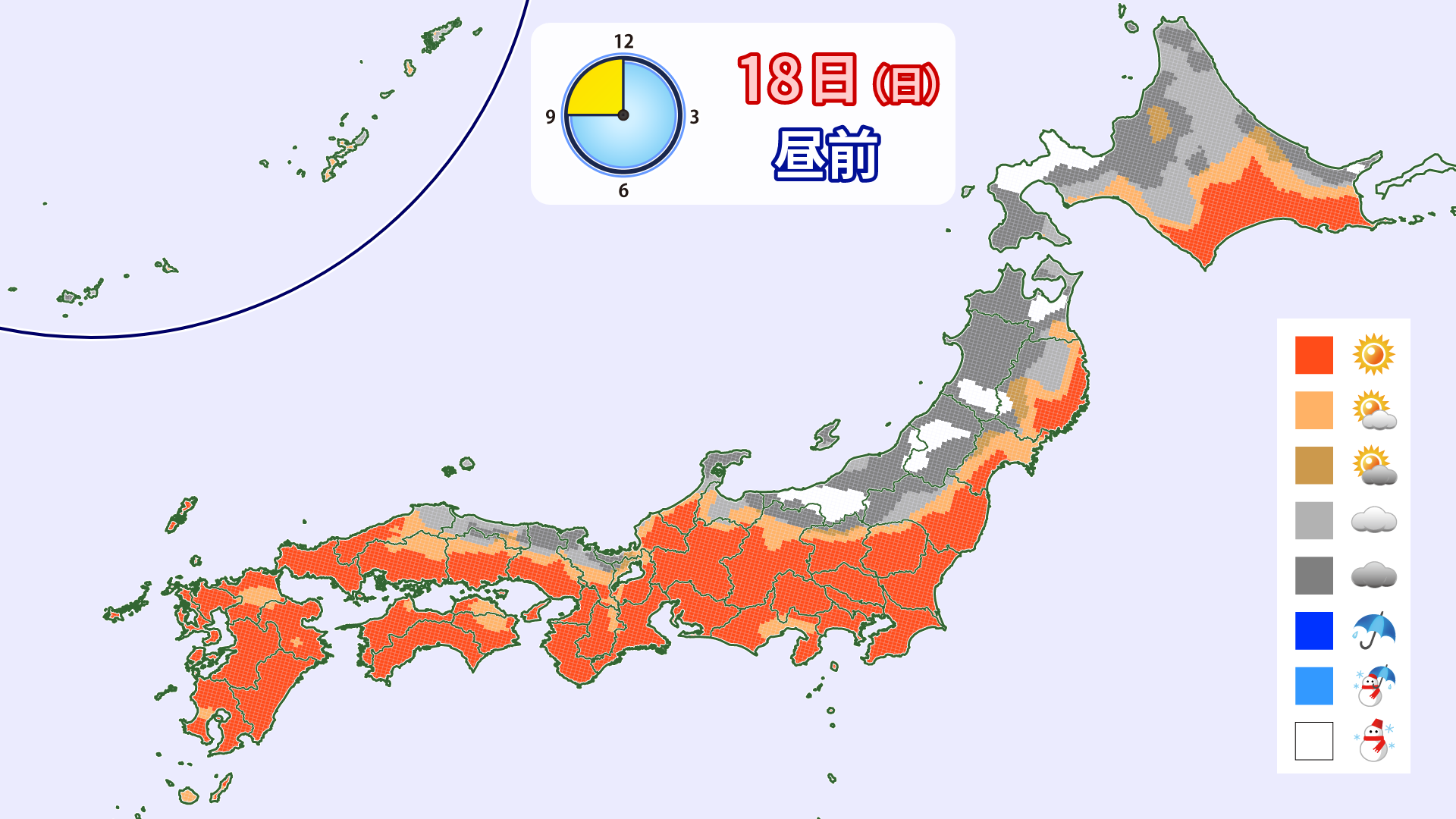
[Hokkaido area]
Snow will fall from the night of the 17th through the early hours of the morning due to the influence of a winter pressure pattern and low pressure. There will likely be some areas with heavy snowfall locally. Strong northerly winds will continue to be prevalent during the day, causing snow and blizzards on the Sea of Japan side. Please pay close attention to the latest weather information
[Tohoku area]
A winter-like atmospheric pressure pattern will develop from the night of the 17th, causing snow to accumulate mainly along the northern mountains. Strong northwesterly winds will be prevalent during the day, with snow expected to fall on and off in some areas, resulting in blizzards. Lift operations may be affected in high-altitude areas
[Yuzawa area]
It looks like we'll be able to enjoy fresh snow for the first time in a while on the 18th. However, there is a possibility of strong northerly winds, so please check the lift operation information carefully
[Shinetsu area]
There may be a light snowfall on the 18th. It will be cloudy during the day with occasional snow
[Joetsu area]
It looks like there will be some snow on the morning of the 18th. Enjoy the feeling of fresh snow for the first time in a while. It will be cloudy during the day
[Other areas]
On the 18th, there will be some cloudy weather on the Sea of Japan side, but it will be mostly sunny. Yellow sand is expected to fly in Kyushu, but other areas are expected to be calm
lastly
There doesn't seem to be much snowfall this weekend, but a full-scale cold wave will arrive from Tuesday the 20th, causing temperatures to drop across the country and snowfall is expected to continue on the Sea of Japan side. The effects of the cold wave are expected to continue for about a week, so there will be areas where the snow accumulation will increase. Let's look forward to more snowfall in the future